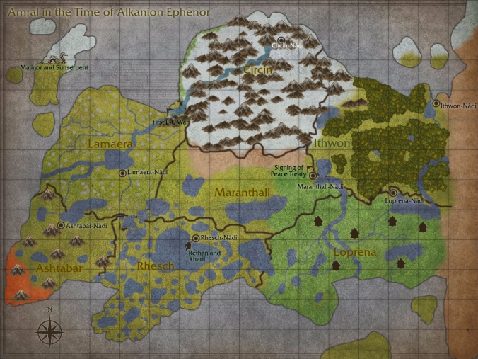
I used a website called inkarnate.com to make this map; it’s a lot more detailed than the last one. I hope you like it, and I hope it makes some things clearer. 🙂
The continent was roughly 3000 miles (4828 kilometers) long, measuring from the northeast corner of Ithwon to the southwest corner of Ashtabar.
The little silver dots on Lamaera were sylvanor trees, for which I had (understandably) no symbol.
The sylvanor trees had a reflective silver bark that was almost luminous, and if you were to run your hand down the bark, it would turn gold under your fingertips in a trail of light. The trees were very, very tall–some of them broke the cloud cover–and they were usually fairly straight as well (at least for the first fifty to a hundred feet), making them ideal for installing stairsteps.
The leaves didn’t start until a few hundred feet in the air; they appeared in large, umbrella-like tufts that–if woven together in a very distinct way–would grow over time to be strong enough and deep enough to build solid, wind-resistant structures right on top of them. Thus, because the ground held many dangers for Lamaerans, even with the protection of their magic, and because they had early fell in love with the sky, they decided to build their homes in the clouds.
After the Lamaerans invented their famous flying ships, many of these trees were used as ports. Water was brought up through the same newly-discovered spell that granted the ships their flight, and it formed sky-lakes that the ships could rest on and use for takeoffs and landings.
Anyway, that kind of got off on a tangent, but an important one for Lamaeran history!
